
Course
Starting at the Tuckeroo Park boat ramp, athletes follow Kedron Brook for 2.5km in a north-easterly direction towards Moreton Bay. The deeper water of the boat channel in Kedron Brook will be to athletes left of red / rectangular channel markers, while the right side of Kedron Brook can be shallow (especially near the entrance of the Bay) with moored boats to navigate around sheltered in the Brook.
The last channel marker is the only green / triangular marker. Athletes are to round this marker with the marker on their left side. Beyond that marker, athletes set their course to Bells Beach Park.
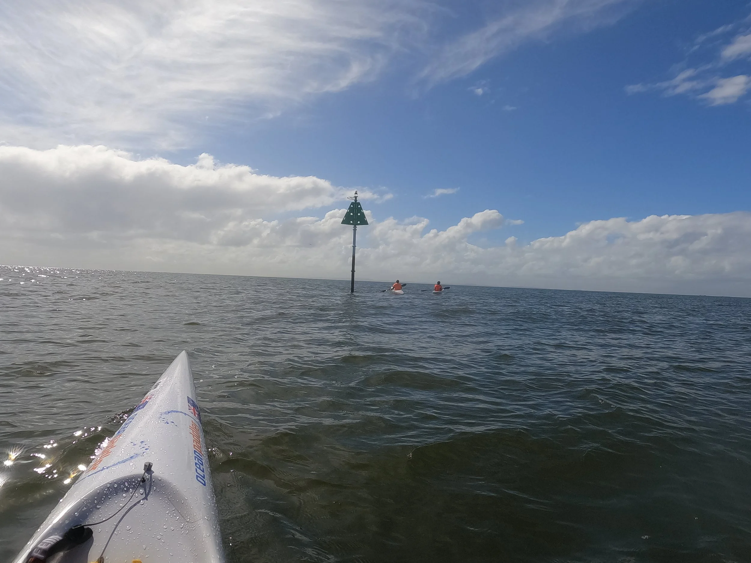
The last channel marker - starboard (green, triangular). Athletes round with the marker on their left.
GPS: -27.341583, 153.115056 (decimal degrees)
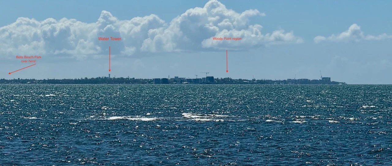
View from Nudgee Beach, similar to view from Nudgee channel marker (April 2026)
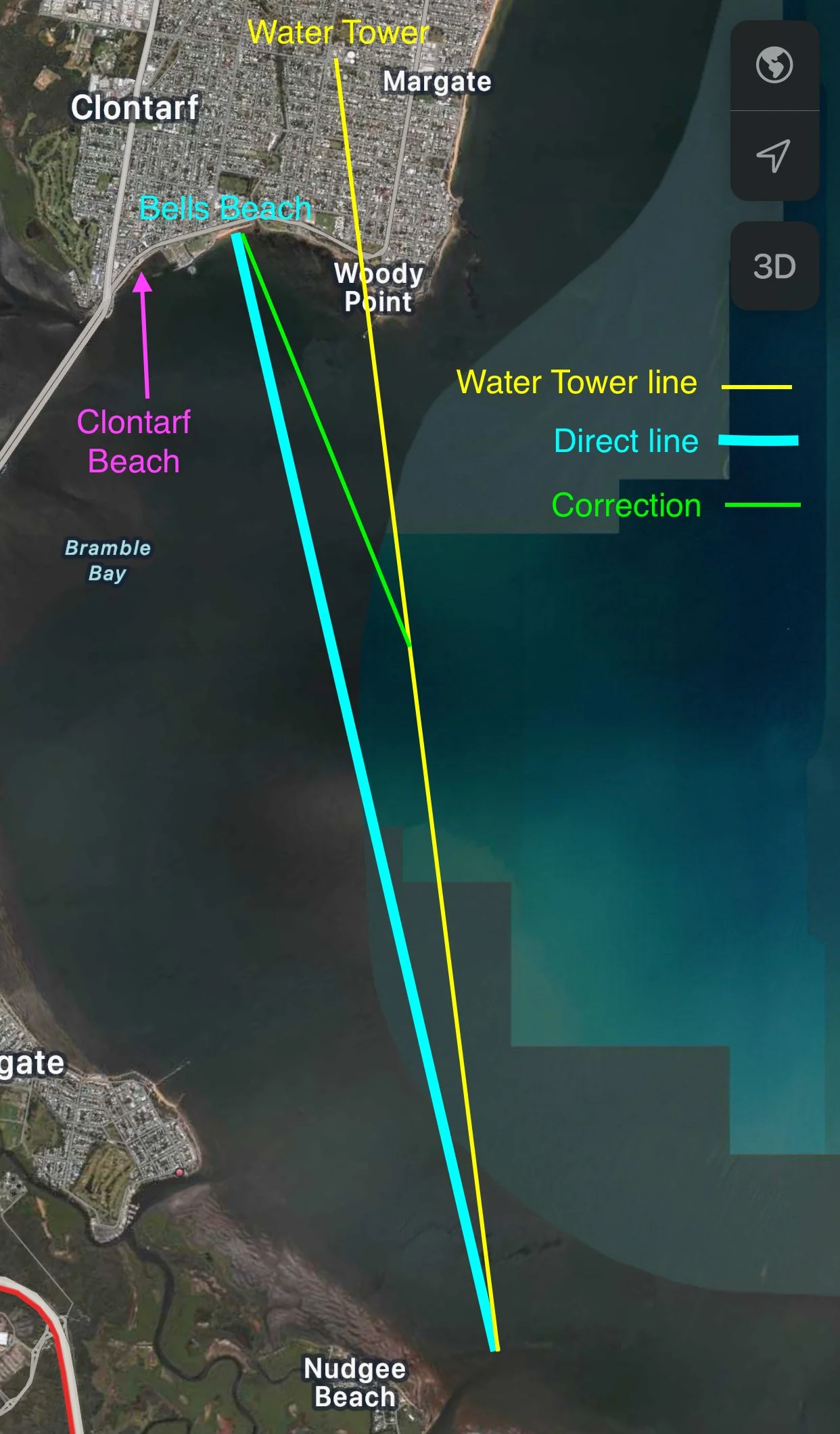
An early visible landmark on the Redcliffe Peninsula is the Redcliffe Water Tower at Margate. Tracking towards the Water Tower will leave athletes with only a small correction to make in the final kilometres as the sand of Bells Beach and Clontarf Beach come into view. Clontarf Beach will be further left (west), where the Ted Smout Memorial Bridge (Hornibrook Highway) meets the Peninsula, while Bells Beach will be between Clontarf Beach and the Water Tower.
A course that is west of the Direct line is NOT RECOMMENDED. Staying closer to land (eg Sandgate) may appeal, but in prevailing SE winds it will result in paddling the final kilometres with winds and swells “side on” pushing paddlers towards the Bridge and Clontarf Beach - when conditions are often at their strongest, and fatigue may be setting in for athletes.
Some may choose a course a little east of the Water Tower line, but the extra distance rarely compensates for any perceived improvement in conditions.
The ideal line is usually the Water Tower line with Correction.
GPS coordinates for Bells Beach Park: -27.257222, 153.090194 (decimal degrees)


